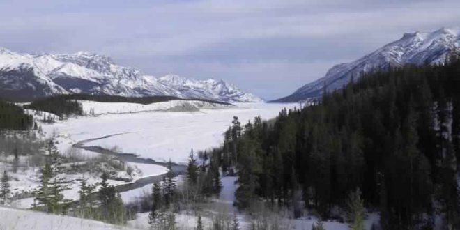
Recent studies of ancient DNA found that the first humans who got into America might not have gone through the ice-free corridor after all, which was previously the most believable viewpoint.
In the paper, which was published Wednesday in the journal Nature, Mikkel W. Pedersen from the Natural History Museum of Denmark and his colleagues studied ancient DNA as well as the remains of plants, animals, and pollen collected from lake sediments in the region and found that it would not have been a viable passageway for migration until 12,600 years ago.
According to Science, this indicates the first settlers to cross into North America must have taken a vastly different route, as the pathway known as the ice-free corridor was not yet available to them. Since this more interior route was not an option, the research team determined travelers may have taken a coastal path as far back as 14,700 years ago.
“This is a really neat and pioneering study,” Stephen Jackson, a paleoecologist with the USGS Southwest Climate Science Center in Tucson, Arizona, who was not involved in the work, told Science. Since the new study examined both traditional data and environmental DNA (eDNA), “we stand to learn a good deal more about how to interpret our records.”
Early migrations most likely traveled along the Pacific coast, study finds
Experts have long asserted that the first people to cross into North America crossed Beringia, a now-submerged region in the Bering Sea that once connected Siberia to Alaska. Until recently, the assumption was that they then continued south by crossing the ice-free corridor, but the new study shows that this path would have been “biologically unviable” at the time.
According to Pedersen’s team, this pathway would have been impassible until roughly 12,600 years ago, as the corridor lacked essential resources such as game animals that would have been necessary for food, and wood for fuel and tools. Unable to travel directly across Beringia, these settlers would have instead followed paths along the Pacific coast, they said in a statement.
Their conclusion comes following an analysis of DNA, macrofossils and other evidence which they extracted from sediments and sequenced en masse using a special technique called “shotgun sequencing” that does not focus on searching for particular species. Using this method, the study authors found that the corridor would have lacked the plant and animal resources that the earliest travelers would have needed in order to survive such an arduous journey.
While there is still debate as to whether these individuals were members of the so-called Clovis people or part of another civilization, “The bottom line is that even though the physical corridor was open by 13,000 years ago, it was several hundred years before it was possible to use it,” co-author Eske Willerslev, an evolutionary geneticist at the University of Copenhagen, explained.
“That means that the first people entering what is now the US, Central and South America must have taken a different route. Whether you believe these people were Clovis, or someone else, they simply could not have come through the corridor, as long claimed,” Willerslev added. “Most likely, you would say that the evidence points to their having travelled down the Pacific Coast. That now seems the most likely scenario.”
Agencies/Canadajournal

 Canada Journal – News of the World Articles and videos to bring you the biggest Canadian news stories from across the country every day

