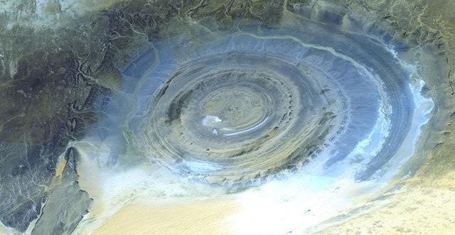
US space agency NASA has released three million photos of Earth’s surface from their internal database, taken over the course of 17 years.
While all of the photos could be seen by anyone for a small fee before last week, they are now on the web for free. For the last decade and a half the Advanced Spaceborne Thermal Emission and Reflection Radiometer (ASTER) has been taking pictures of our stunning planet.
The Japanese built instrument is flying around the planet on a NASA research satellite taking pictures of our ever changing landscape using 14 different spectral bands to see things you can’t see with the naked eye. It’s been watching as our cities grow, our glaciers shrink, and our lakes wax and wane from the dry times to the wet times. And now you can see it all for yourself on the free website below. Here are a couple examples of what you can find…
These two images are of Lake Meade in the Desert Southwest, the lake that is held back by the Hoover Dam. This shows an image taken in 2000 before a decade long drought began to shrink one of the biggest lakes in the world. The second picture was taken in 2015 and shows how much the lake has dried up in 15 years. Photo courtesy of NASA/GSFC/METI/ERSDAC/JAROS, and U.S./Japan ASTER Science Team
Agencies/Canadajournal
 Canada Journal – News of the World Articles and videos to bring you the biggest Canadian news stories from across the country every day


Is there a link to the website where the photos can be seen?