The image of the Earth from space is so seared into human consciousness that it is hard to conceive what it was like to live without the picture of our planet as a blue sphere that we all now carry in our minds.
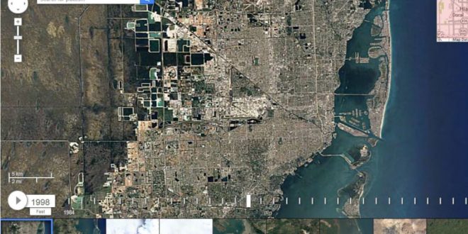
Google Earth’s updated Timelapse feature has provided a glimpse of what’s been going on from above since 1984 and the obvious answer is growth.
The search bar at the top of the screen enables you to type in where you would like to view, along with a timeline at the bottom where you can scroll from year to year.
In collaboration with the US Geological Survey, NASA and TIME, the company first released the time-lapse of the Earth in 2013 after collecting satellite images from 1984 to 2012. Four years later Chris Herwig, Program Manager at Google Earth Engine states, “we’re making the largest Timelapse yet, with four additional years of imagery, petabytes of new data, and a sharper view of the Earth”.
Herwig goes on to say “Using Google Earth Engine, we combined more than 5,000,000 satellite images… to create 33 images of the entire planet, one for each year.” The company has teamed up with TIME to give updated takes on interesting locations. Locations that have changed dramatically since 1984 include Canada’s own Fort McMurray, Dubai, the Las Vegas strip, New York City and the Northern Glaciers.
The interactive time-lapse can be found on Google Earth Engine. The Earth Engine organizes the world’s information and makes it universally available for analysis. Only time will tell what the next 30 years will reveal.
Agencies/Canadajournal
 Canada Journal – News of the World Articles and videos to bring you the biggest Canadian news stories from across the country every day


