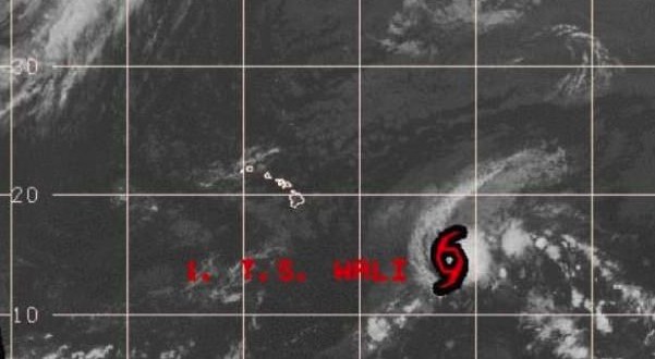
Wali continues to fizzle. Forecasters downgraded it to a tropical depression Friday morning and then to a post-tropical cyclone Friday afternoon.
It became the first tropical storm of the 2014 Central Pacific Hurricane Season Thursday.
Wali continues to move to the northwest at 12 mph and this motion is expected to continue until Wali dissipates within 36 hours.
At 5 p.m. Friday, it was 715 miles east southeast of Hilo and carried maximum sustained winds of 30 mph with higher gusts.
“Wali is expected to become a post-tropical remnant low within 12 hours and to dissipate within 24 hours,” a midday NWS forecast advisory read. “Although the remnant surface trough or wave will likely not contain any strong winds, it still poses a rainfall threat.”
Heavy rainfall, according to the NWS, is expected to affect the Hawaiian Islands beginning Saturday evening. Widespread rainfall amounts of 5 to 10 inches are expected with up to 12 inches locally.
The flash flood watch issued by NWS on Thursday is still in effect for the entire state from 6 p.m. Saturday to 6 p.m. Monday.
Enhanced showers are expected to reach the windward side of the Big Island and Maui on Saturday night and spread to the rest of the state by Sunday.
Department of Land and Natural Resources officials said they will be monitoring the weather and may close the Kalalau trail in Kee.
“Areas may be closed with little notice, for public safety, if weather conditions necessitate,” DLNR spokeswoman Deborah Ward wrote in an advisory.
Agencies/Canadajournal
 Canada Journal – News of the World Articles and videos to bring you the biggest Canadian news stories from across the country every day


