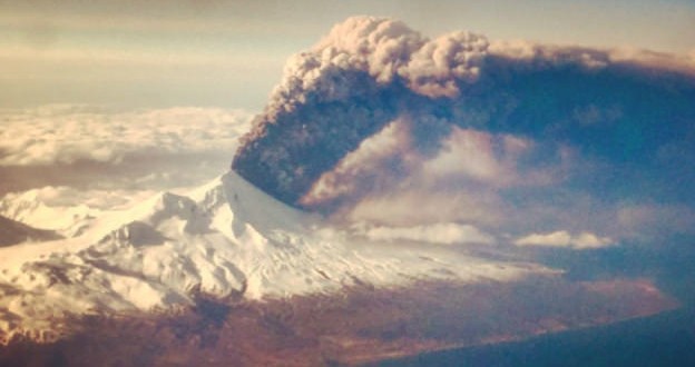
The Pavlof volcano in Alaska erupted abruptly on Sunday, right before 4:00 p.m. local time. This was unexpected at the time and the volcano was on the lowest alert status since January 15th last year. This marks the first eruption since November 2014, and there are plenty of pictures to show it in all its glory.
Although this sort of thing is relatively common, this morning the volcano alert level was raised to “warning,” meaning it’s a potentially hazardous eruption with significant emissions being spewed into the atmosphere. The USGS also raised the aviation code to “red,” meaning that flights are being re-routed to avoid the ash plume. Incredible shots are being captured by the local scientists and by passengers on planes that traveled near the volcano before the alert was raised.
Satellite image of 500 km ash signal from #Pavlof, 4:19 am 28 Mar https://t.co/UEZMnpLj9h pic.twitter.com/0YdMaWLPLW
— Alaska AVO (@alaska_avo) March 28, 2016
According to volcanologist Ben Edwards, there’s a possibility that Pavlof could morph into something more menacing, but that has to do more with our weather than the eruption.
The ash cloud from the eruption is drifting 640 kilometres north, prompting Nav Canada to tell airlines to take precautions. Pavlof is located along the flight path for many routes between East Asia and the West Coast of North America.
Some flights bound for Vancouver International Airport from Beijing, Seoul, Hong Kong, and Manila are experiencing slight delays in their arrival due to a change in flight path to avoid the ash cloud. No flights have been cancelled as a result of the eruption.
Agencies/Canadajournal
 Canada Journal – News of the World Articles and videos to bring you the biggest Canadian news stories from across the country every day


