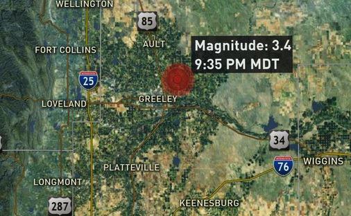
The U.S. Geological Survey (USGS) confirms a 3.4 magnitude earthquake hit northeast of Greeley, Colorado on Saturday night. The quake could be felt in Greeley, Evans, Eaton, LaSalle and Kersey.
The epicenter of the quake was located about seven kilometers north of Greeley and was recorded at 9:35 p.m. According to the coordinates provided by the USGS, it occurred about 7.8 kilometers below a field near the intersection of County Roads 66 and 43, just east of Sand Creek.
Dispatchers had no initial reports of damage.
Another USGS map shows weak shaking from the quake may have been felt in Fort Collins or perhaps Longmont, but would likely not have been felt in Denver.
Colorado is considered by the USGS to be a region of minor earthquake activity, with most quakes being centered west of the Front Range. In fact, the USGS webpage about Colorado’s earthquake history says, “Eastern Colorado is nearly aseismic, with just a few epicenters in the Arkansas and Platte River Valleys.”
Agencies/Canadajournal
 Canada Journal – News of the World Articles and videos to bring you the biggest Canadian news stories from across the country every day


